


Dumyat (Castle Law)
|
Details last updated: |
2020-06-02 |
|
Site Owner / Negotiator |
LLSC / ex OPC |
|
Site Contact |
|
|
Special Rules: |
|
|
Site History: |
Site originally run by Ochils Paragliding Club which has alas now ceased to operate.
|
|
Altitiude at Launch: |
1370 |
|
Height top to bottom: |
1360 |
|
Airspace: |
Scottish TMA above at 4000 feet |
|
National Grid Reference: |
|
|
Wind Direction: |
Wind Directions SSE-SSW |
|
Brief Site Description: |
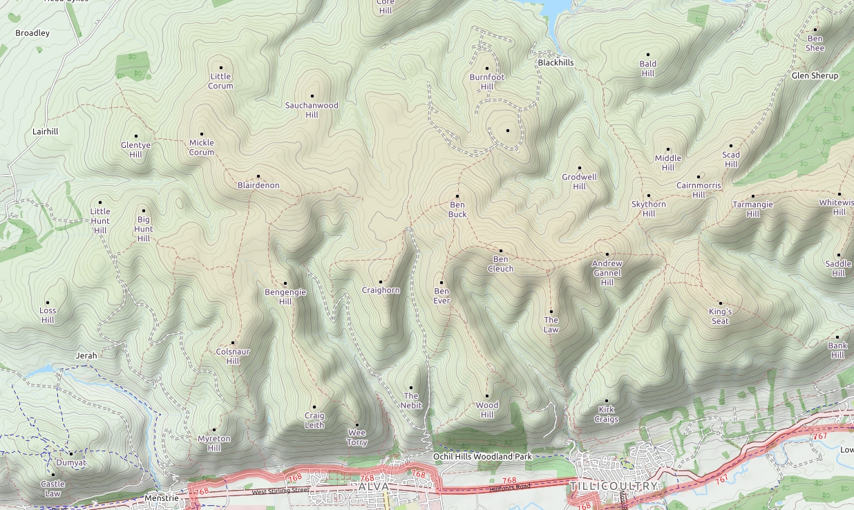
The Ochils are a range of 6 steep, south-facing hills which extend to the East from Stirling to Dollar, along the North edge of the Forth Valley. Dumyat is the Western-most hill, which is popular with walkers and tourists because of it’s easy climb from a carpark halfway up, and impressive views over Stirling and down to the Forth Bridges. The ochils range in height from 525m (Wood Hill), to Bank Hill in Dollar at 343m above sea level. Launches are possible from all of the Ochil hills, which generally take SSE-SSW. Be careful of the sea breeze, which arrives fairly predictably from the west towards the end of the afternoon.
|
|
How to get there: |
|
|
Restricted Areas: |
|
|
Parking Notes: |
Either park at Sherrifmuir Road Car Park (56°09'33.8"N 3°54'49.0"W and walk up the tourist path, or at the Hillfoots road car park (56°08'59.2"N 3°52'59.0"W and walk up from the bottom. If parking at the bottom, please avoid using the gravelled area adjacent to the row of white cottages by the landing field, as this parking is in use for the residents of the cottages. From the bottom car park (Hillfoots road, turning left the path at the back will take you up to the main tourist path to Dumyat, a short climb for 30% hill height and then an easier angle for the remainder of the walk. After crossing the second burn, the path to Castle law is visible to the right on the rise before the summit of Dumyat. |
|
Landowners: |
|
| CANP |
Link to CANP system to notify other aircraft of activity in this area. |
|
Launch Notes: |
Taking the path to the right from the bottom car park will lead to a direct approach up the Burnwarroch gulley, which is a steep and sustained climb which requires some bracken bashing and optimistic routefinding skills. Once gained, the gulley is easy to follow, and taking the second gulley off to the left will bring you up just behind the Castle Law launch. The flat top of Castle law (between the two cairns) is a good sized space to lay out. It is often in the lee of a south wind coming up the face, so the wing will require an energetic start to get it up. In thermic conditions with a South wind, the Burnwarroch gulley to the East of launch can give a false indication that the wind is coming from SE. Inflate the wing above your head and ground handle to see the true wind direction. If there is any West in the wind, a lower takeoff to the West of the cairns is accessible, 100m away. |
|
|
|
|
XC Tips: |
|
|
Top Landing Notes: |
|
|
Bottom Landing Notes: |
The fields closest to the crag, across the road have been agreed with the landowner as landing fields. Avoid landing in fields with livestock, please use the gates to exit the fields and close gates behind you. |
|
|
|
|
Hazards: |
|