


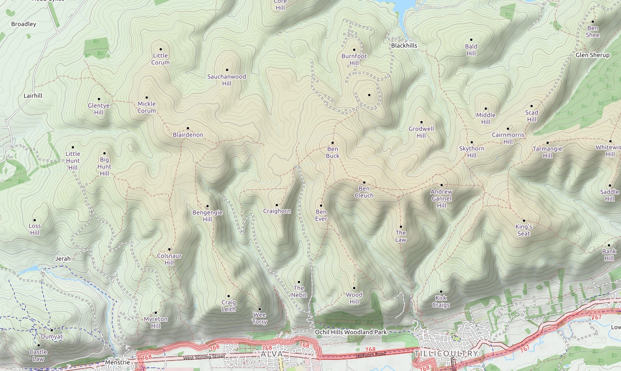
Myreton
|
Details last updated: |
2020-06-01 |
|
Site Owner / Negotiator |
LLSC / OPC |
|
Site Contact |
|
|
Special Rules: |
|
|
Site History: |
Previously the main Ochils Paragliding Club site with 4 X 4 access both sadly now no longer existing. |
|
Altitiude at Launch: |
1250 |
|
Height top to bottom: |
1200 |
|
Airspace: |
Scottish TMA at 4000 feet |
|
National Grid Reference: |
NS 856 979 |
|
Wind Direction: |
South best but also possible in SSE or SSW |
|
Brief Site Description: |
Small grassy launch above a steep face. |
|
How to get there: |
Head for the village of Menstrie. |
|
Restricted Areas: |
|
|
Parking Notes: |
Park at the top of School Lane near to junction with Ochil Road NS851970. |
|
Landowners: |
|
|
CANP |
Link to CANP system to notify other aircraft of activity in this area. |
|
Launch Notes: |
Track up the hill clearly visible from the parking place. This is a public footpath.Follow up until a short steep hike brings you to the first launch spot Little Myreton. There is a second launch spot known as big Myreton 40m higher. Little Myreton is best in a SSW wind and Big Myreton in a SSE. |
|
XC Tips: |
In SW wind the jump across to Craigleith is straightforward. In a SE wind the route to Dumayat is also straightforward., |
|
Top Landing Notes: |
|
|
Bottom Landing Notes: |
Land in any of the large fields at the base of the hills clear of livestock. Confident pilots can land on the playing fields in Menstrie. |
|
Hazards: |
Care needed if the wind goes west due to rotor from Dumyat. |