


Tinto - North
There's a distant view of Tinto from Broughton with our webcam on that hill (see its site guide here)
|
Details last updated: |
2020-05-07 |
|
Site Owner / Negotiator |
LLSC |
|
Site Contact |
|
|
Site History: |
Tinto is the main hill for flying in the Central Belt of Scotland. Its proximity to Glasgow and Edinburgh gives its popularity for both free flying and training. Training schools frequently use the site. |
|
Altitiude at Launch: |
1493ft/455m |
|
Height top to bottom: |
459ft/140m |
|
Airspace: |
TMA CLASS 'D' above 5500ft Check you have latest airspace details loaded on your navigation device or access to an up to date CAA chart. |
|
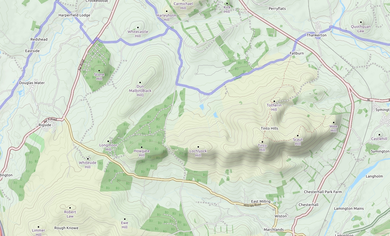
National Grid Reference: |
NS 924345 |
|
Wind Direction: |
North-East to North-West, best in North, can be rough in North-West. See current conditions on the wind monitor pages. |
|
Brief Site Description: |
Large open hill with 4km ridge running east to west. |
|
Special Rules: |
Please close the bottom gate to the track as there are sometimes grazing animals further up the hill. |
|
How to get there: |
From the M74 Junction 11 or 12 (Happendon Services) take the A70 heading east then first right onto the B7055 after passing through Rigside. Follow road for approx. 5km to junction with the white house on the right and track on the left. |
|
Restricted Areas: |
Lambing does not usually stop flying here, but if in doubt, see the farmers before flying. |
|
Parking Notes: |
Park in the quarry at the top of the track. Paragliders wishing to fly Greenhill, park in the lay by halfway up. 4 wheel drive vehicles can be driven up the new track as far as the wind monitor mast at owners risk. |
|
Landowners: |
Farmers - Lochyloch Farm |
| CANP |
Link to CANP system to notify other aircraft of activity in this area. |
|
Launch Notes: |
Hang-gliders:Walk up the new track to the wind monitor mast, cross the fence at the stile and continue to the rigging area. If the wind light, you can continue along the ridge to several higher take off locations, but the top launch is a long walk. |
|
Paragliders: As per HG. |
|
|
XC Tips: |
Can be limited by airspace to the north - Check you have latest airspace data on your navigation device or access to an up to date CAA chart. If sufficient height is gained from take off it is possible to cross the gully onto the west face of Tinto and the summit. Good thermals are produced from the dark heather in the lower moor, and track up into the 'bowl' which tends to work better than the other slopes in light and thermic conditions. This is an excellent start for cross country flights to the south. Light wave has been recorded in north westerlies. Check for ripples on the surface of the reservoirs as an indication of wind strength. XC records: PG 90km, HG South of border. |
|
Top Landing Notes: |
The majority of the ridge is open and good for top landing. Paragliders: don't fly behind the wall when coming in to top land. |
|
Bottom Landing Notes: |
Hang-gliders: Land in the moor at the bottom of the hill. Access to the moor can be gained by the north road. An alternative in light winds is to fly over the ridge and land in the south landing field (in the lee of the hill). This is less of a walk out and has better access to your car. |
|
Paragliders: Can land anywhere but it is usually best to top land and walk down to the quarry than land in the moor and walk out. |
|
|
Hazards: |
There are no major hazards with the exception of a small bund at the base of the 'bowl' which was once used as a rifle range. There is a broken wire fence and metal posts along this bund which are hard to identify from the air. |